In recent years, increased investment in active travel infrastructure has raised the need for more comprehensive wayfinding and signage. This need derives from various factors, primarily the anticipation of, or desire for, a greater volume of users and diversity of user types.
Infrastructure improvements can also provide an opportunity to introduce branded wayfinding to support route identity. Most obviously, enhanced and well-defined route infrastructure deserves an elevated level of wayfinding provision to accompany and promote it. But what form and function should these solutions take?
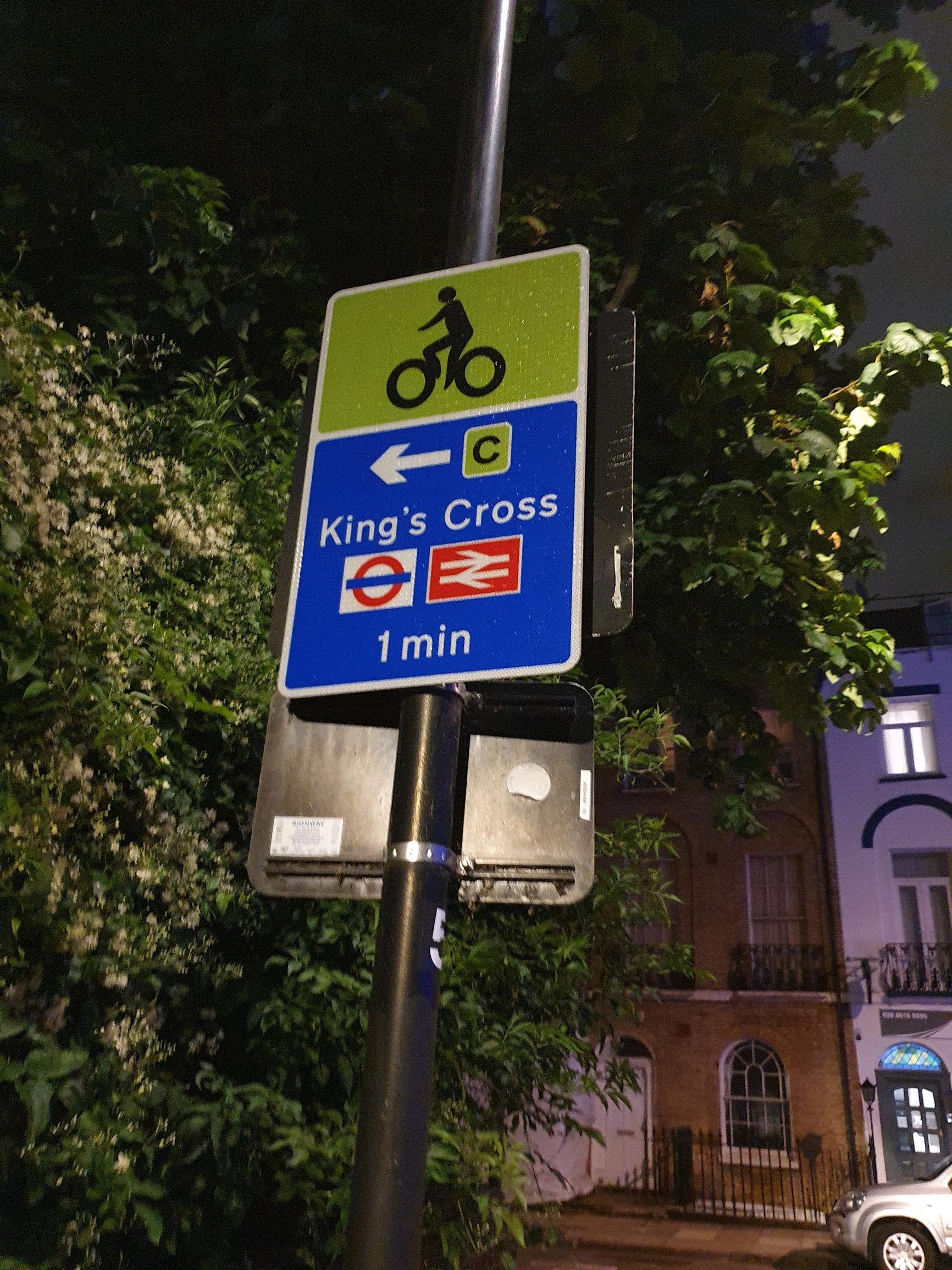
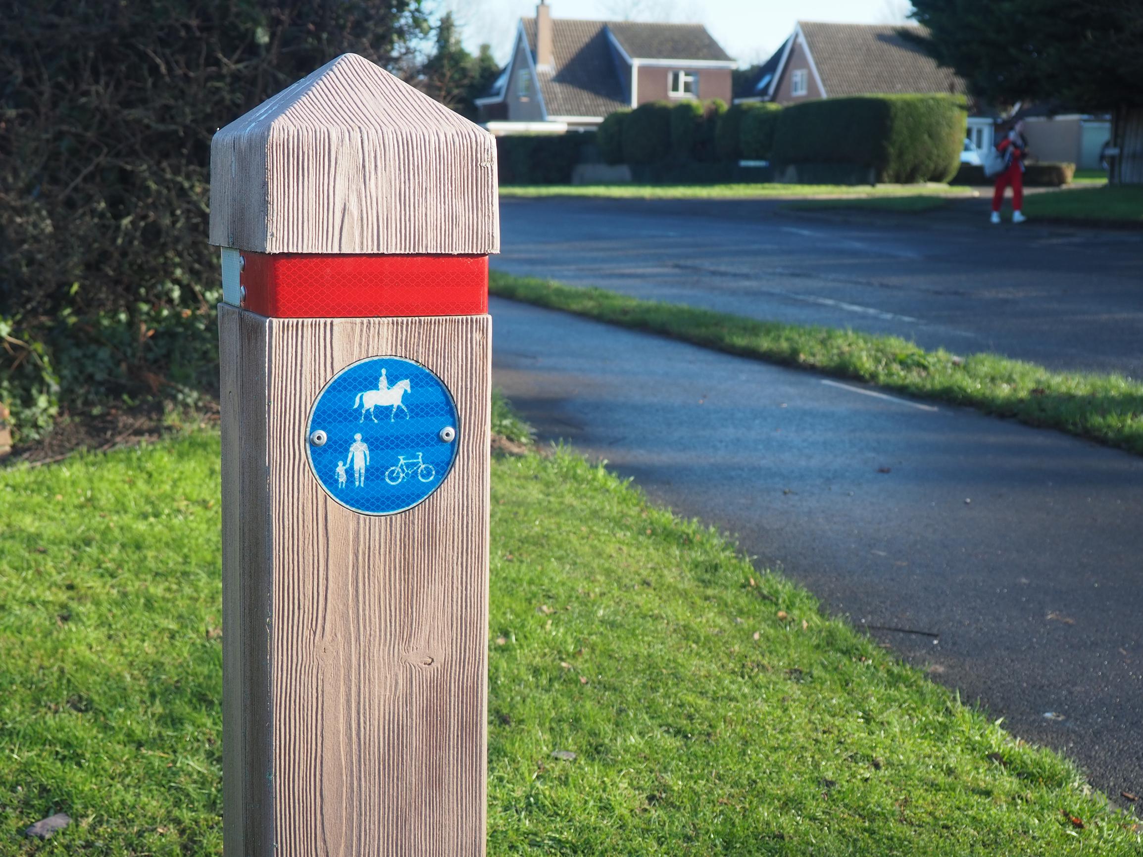
Directional TSRGD (Traffic Signs Regulations and General Directions) signage for pedestrians and cyclists has historically been the default solution for linear route wayfinding across the UK.
These familiar blue signs are recognisable to most users, and their consistency in design can be beneficial in helping users navigate unfamiliar routes and environments.
However, the application of these products can be inconsistent, and they do not always meet user needs based on current best practice wayfinding principles, particularly in environments where TSRGD does not apply, away from the main highway.
Our AtkinsRéalis Wayfinding team has designed many urban map-based wayfinding schemes focused on towns or cities as a whole. But over recent years we have increasingly been asked to design for active travel routes in isolation, to support infrastructure development or improvements. These schemes provide a unique, nuanced set of challenges, compared to designing for a polycentric town or city.
User needs in these environments are different, requiring a rethink in some design and best practice conventions. For instance, emphasising wayfinding information along a route, further away from the sign location, can be more valuable, rather than focusing more on the immediate locality, as is done commonly in urban pedestrian systems.
Schemes also need to cater for multiple modes, each with equal emphasis. Incorporating differing sets of user needs from various modes into one product family effectively can be challenging, particularly when combining walking, cycling, and wheeling, as these different user groups require information at varying distances and scales. There are good reasons why many wayfinding systems focus predominantly on one single mode, such as Legible London (walking) and London Cycleways (cycling) systems in our capital.
Despite these challenges, research and user testing conducted as part of our recent schemes have found significant value in including a physical map within active travel wayfinding product families. The success and popularity of map-based totems have been the catalyst for the influx of new town and city wayfinding systems over the last fifteen years. Introducing physical map products to linear routes and active travel networks shares many benefits, particularly when considering anticipated wayfinding requirements for those leaving the route.
This is where a detailed map of the local area around the user, showing key destinations they may be trying to find, holds real value, especially as travelling in a route corridor environment can be disorientating.
We have found it important to accompany local area maps with ‘tube line style’ route diagrams of the current route the user is on, either on the same map-based totem or as a standalone ‘route marker’. These have been successfully deployed across active travel networks in many countries and help to inform understanding of the key locations the route passes through, enabling the user to build a better mental map of network connections for forward journey planning.
These meet users’ immediate wayfinding needs upon joining a route or provide confirmation along it, dovetailing well with local area maps for user needs when leaving the route.
Wayfinding systems can play a dual role in improving navigational support and providing brand application and profile. Typically, when designing wayfinding for a town or city, any branding often ties in with the local authority or provides a gentle nod to the history or character of a local area. For the active travel routes and networks we have designed, it has been imperative to use wayfinding signage as the primary medium to also brand the route and give it a form of identity.
Unique colour palettes and designs for map-based totem or route markers create a distinct association with the route or network. Repeating colours and route logos can help users easily identify where they are and which directions at junctions represent route continuation. Developing product solutions beyond standardised TSRGD products also provides the opportunity to create a defined route identity and brand.
• Start with an initial scheme strategy study, to develop a framework for future system design, development and application. Gain wider approval and consensus from your stakeholders on this strategic approach before progressing with a detailed design.
• Understand user types and each group’s unique wayfinding needs as part of this strategy stage to ensure this leads all design decision making. Engage with local accessibility groups to ensure the end-solution is inclusive.
• Similarly, establish brand aspirations and requirements early on, and holistically plan for how these can be integrated into the wayfinding system.
• Develop solutions that are aligned with each scheme’s unique user requirements, and consider the use of map-based and route marker types to support directional signage.
• Consistency is key: as my colleagues Rachel Evans and Jo Bacon outlined in this recent article, users need to feel confident in active travel networks to increase walking, cycling or wheeling uptake. Having a wayfinding system that is consistent in look and feel, as well as application, gives users confidence in the information and a likelihood to rely on it more to use the route and explore.
• Place sustainable materials at the heart of the design process and engage with sign suppliers to identify options that best align with design intent.
Ryan Burgess is the Wayfinding Technical Director at AtkinsRéalis and leads a specialist Wayfinding design team that works across a range of environment types.
TransportXtra is part of Landor LINKS
![]()
© 2025 TransportXtra | Landor LINKS Ltd | All Rights Reserved
Subscriptions, Magazines & Online Access Enquires
[Frequently Asked Questions]
Email: subs.ltt@landor.co.uk | Tel: +44 (0) 20 7091 7959
Shop & Accounts Enquires
Email: accounts@landor.co.uk | Tel: +44 (0) 20 7091 7855
Advertising Sales & Recruitment Enquires
Email: daniel@landor.co.uk | Tel: +44 (0) 20 7091 7861
Events & Conference Enquires
Email: conferences@landor.co.uk | Tel: +44 (0) 20 7091 7865
Press Releases & Editorial Enquires
Email: info@transportxtra.com | Tel: +44 (0) 20 7091 7875
Privacy Policy | Terms and Conditions | Advertise
Web design london by Brainiac Media 2020